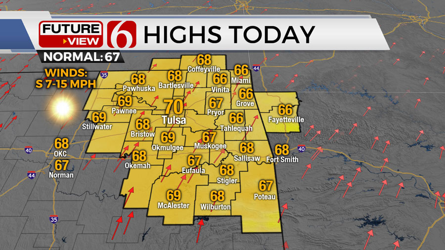
Mostly clear skies are expected on Thursday in Oklahoma, with afternoon temperatures climbing to the upper 60s accompanied by south winds ranging from 7 to 15 mph. The weather pattern over the weekend will bring spring-like conditions to the state, with highs in the lower 80s.
A developing storm system may lead to a chance of a few thunderstorms late Sunday night into early next week, with potential threats of strong to near severe weather.
On Tuesday morning, another cold front will move through the area, resulting in a cooldown for the middle of the week.
Weather Outlook for Oklahoma on Thursday, March 28 and Friday, March 29
Thursday morning will start off with clear skies and light winds, allowing temperatures to begin in the lower 30s. After a light freeze in some areas, temperatures will rise to the mid and upper 60s later in the day.
Gusty south winds will develop on Thursday night as an area of low pressure intensifies across eastern Colorado.
Friday is expected to bring much stronger south winds, ranging from 20 to nearly 40 mph. Despite a mostly dry low-level flow, fire spread rates are likely to increase throughout the day.
By late Friday night and early Saturday, low-level moisture will move into parts of the area. Although wind speeds on Saturday will be slightly lower, they are still expected to range from 15 to 25 mph.
Weekend Weather Forecast for Oklahoma
Over the weekend, a robust upper-level trough will form to the west of Oklahoma. A weak cold front will approach southern Kansas on Saturday before stalling across the northern part of the state. This boundary is anticipated to move back northward late Saturday night or early Sunday morning.
Easter Sunday morning will start with temperatures in the 60s, rising to near 80 in the afternoon under mostly to partly cloudy skies. A dryline will likely form near or west of I-35 late Sunday afternoon or evening.
A disturbance associated with the trough could trigger scattered thunderstorms late Sunday night and early Monday morning, some of which may be strong to near severe.
Weather Conditions for Next Week in Oklahoma
Monday will bring higher chances of scattered thunderstorms as the cold front moves southward and additional forcing approaches from the southwest. Morning temperatures will be in the 60s, reaching near 80 during the day.
Late Monday night, the cold front will progress southeastward, leading to additional storm development in Eastern Oklahoma, including potential severe threats. The front is expected to clear the area early Tuesday, ushering in cooler and drier air through midweek.
An upper-level low passing over Northern Oklahoma on Tuesday afternoon will keep daytime highs in the 50s, with temperatures rebounding into the 60s by Wednesday.
Toward the end of next week, there is a possibility of a storm system approaching the region, which could impact potential eclipse viewing. More detailed forecast scenarios will be provided in the upcoming days.
